


Machilipatnam Lighthouse
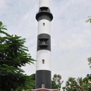
Machilipatnam Lighthouse is shown from a white, round, concrete tower with black bands, 3.8 miles NNE of the mouth of Machilipatnam Creek.
The great tsunami of 26 December 2004 swept away hundreds of people on the beach and reached the base of the lighthouse, but the tower was not damaged. The original light was on a flagstaff; this lighthouse replaced a much shorter tower built in 1930. Located behind Manginapudi Beach, about 15 km northeast of Machilipatnam.
Latitude: 16o 14' 48'' N
Longitude: 81o 14' 00'' E
For more details click below.
Master Ledger of Machilipatnam Lighthouse(417.61 KB)

